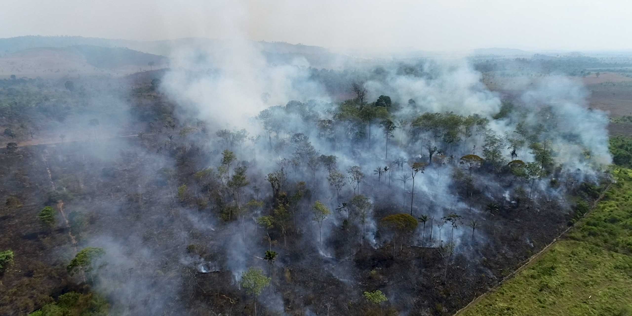
Land use, land-use change, and clearing of forest account for 25 percent of global greenhouse gas emissions. Brazil is the fifth largest emitter on the planet after China, USA, Russia, and India. While two thirds of emissions come from fossil fuels in the top four, two thirds of Brazilian emissions come from land use and land-use change. Tropical forest in Southeast Asia and the Congo Basin which provide critical carbon sinks are suffering from the same environmental degradation and loss of life-sustaining biodiversity. Reducing emissions and increasing carbon storage in these regions is critical to neutralize global emissions by mid-century and achieve the Paris Agreement target of limiting the temperature increase below two degrees.
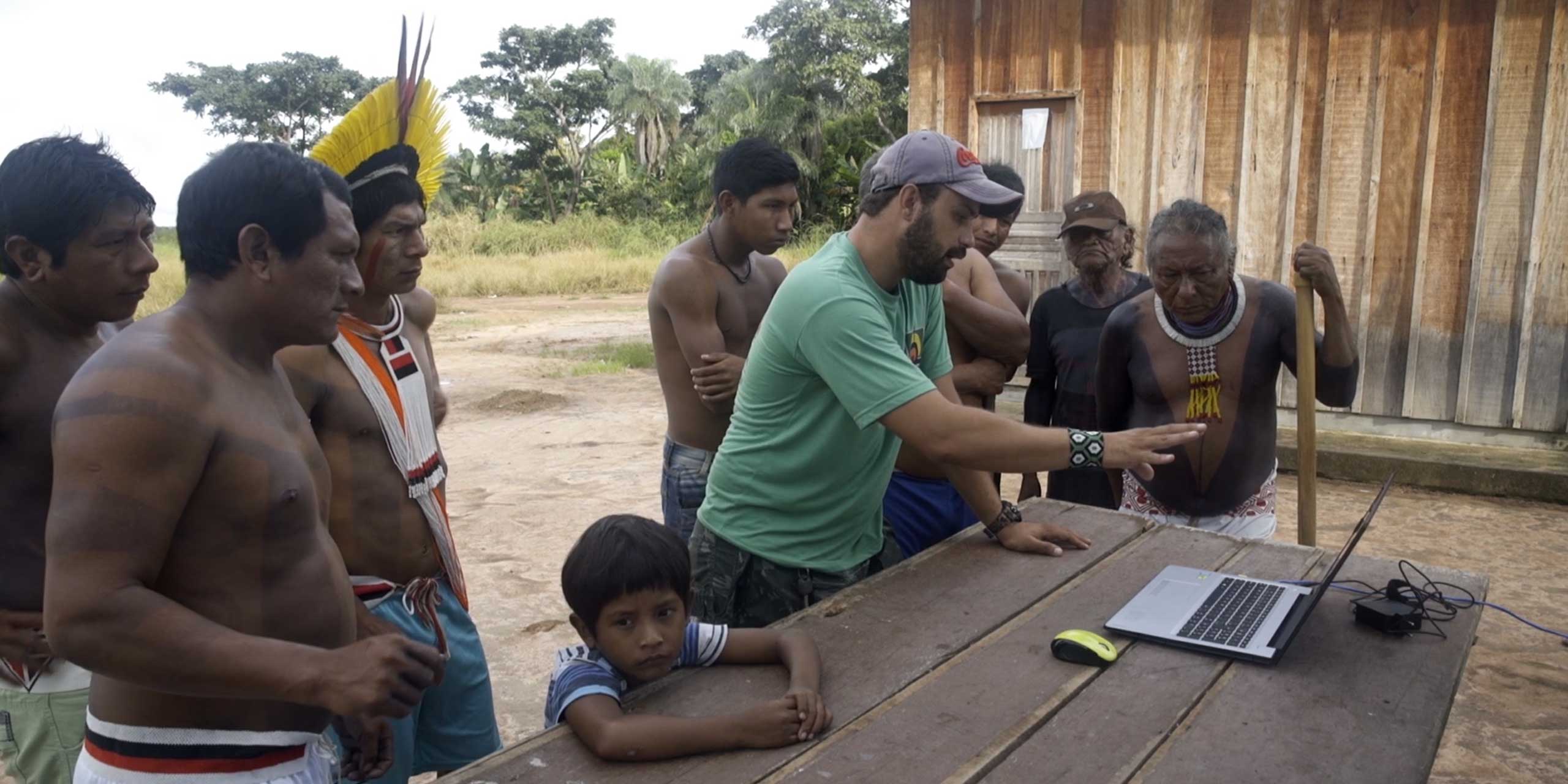
While many initiatives monitor deforestation, there is sparse information on the transformations that happen after deforestation. Land cover and land use mapping with traditional methods is slow and prohibitively expensive at the scale needed. This lack of capacity, accountability, and actionable data can cause poor decision-making related to land use change. MapBiomas combines leading practices in remote sensing, computer science, and local land use expertise with multiple global satellite images to create the most comprehensive information on Brazilian land cover and land use available with real-time insights. The initiative has produced 35 years’ worth of maps in less time and budget than it takes to create a single year of maps by traditional methods.
Other fronts include mapping all fire scars and water surface of Brazil monthly since 1985 and the monitoring of mining, infrastructure, soil degradation in pastureland and secondary vegetation or forest regrowth. Since 2019, MapBiomas has also validated every deforestation alert in Brazil. With these maps it becomes possible to understand all changes in Brazilian territory in 30 meter resolution from 1985 to present. All data as well as all methods and source codes of MapBiomas is provided in a free, open, and interactive data portal.
MapBiomas sees a future where the land system in Brazil is a net sink of greenhouse gas emissions, making Brazil the first large country to achieve net zero emissions and inspiring others to follow its lead. This new reality will be achieved while protecting the rights of Indigenous people and local communities, and with coordinated, data-based decision making from government, businesses, civil society, and agriculture. The initiative began in 2015 in Brazil and expanded in 2018 with full empowerment and coordination by local organizations throughout South America and Indonesia.
Land use, land-use change, and clearing of forest account for 25 percent of global greenhouse gas emissions.
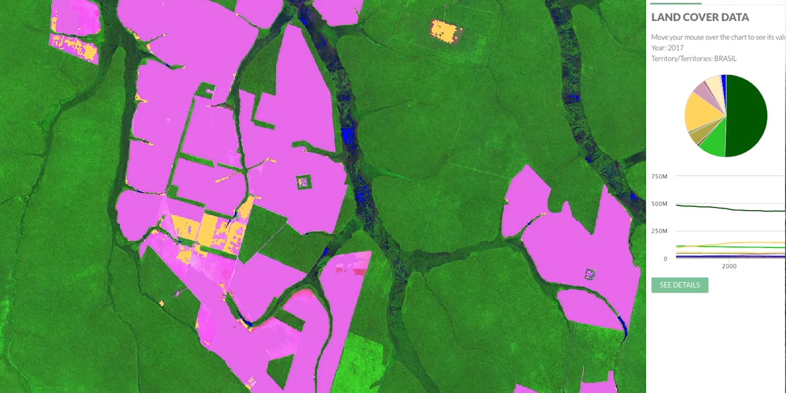
MapBiomas combines leading practices in remote sensing, computer science, and local land use expertise with multiple global satellite images to create the most comprehensive information on Brazilian land cover and land use available with real-time insights.
Tasso Azevedo is a consultant and social entrepreneur in the fields of forests, sustainability, and climate change and general coordinator of the System for Estimation of GHG Emissions (SEEG) and MapBiomas.
The MapBiomas platform has prompted over 8000 actions against deforestation in Brazil and has inspired local replication in other regions of South America and Indonesia.
MapBiomas is working towards a future where the land system in Brazil is a net sink of GHG emissions, making Brazil the first large country to achieve net zero emissions and inspiring others to follow its lead.
MapBiomas open sources its methods, originally developed for Brazil, as a public good for local institutions and networks to scale globally and provides tailored technical support to both replicators and users.
General Coordinator, MapBiomas
Tasso Azevedo is a consultant and social entrepreneur in the fields of forests, sustainability, and climate change and general coordinator of the System for Estimation of GHG Emissions (SEEG) and MapBiomas - a network dedicated to maps and unveil in high resolution the land use change over the history in Brazil, Indonesia and through South America. Tasso was founder and director of the Institute of Forest and Agriculture Management and Certification (IMAFLORA), Director of the National Forest Program at the Ministry of Environment, Secretary General of the National Forest Commission, and former Chief & Director General of the Brazilian Forest Service. Tasso was one of the key people involved in the design and implementation the National Plan to Combat Deforestation in the Amazon, the Amazon Fund, and the Brazilian targets to reduce Greenhouse Gas emissions. He is Brazil Lab Affiliated Scholar at Princeton University. In 2013 he won the Bright Award, Stanford University's Global Sustainability Award, was a TED Global Lecturer in 2014 and a climate and forest consultant for the opening ceremony of the Rio 2016 Olympic Games. Tasso is also a Senior Ashoka Fellow and a board member at Rainforest Alliance, Preferred by Nature, Imaflora, and Instituto of Environment and Energy (IEMA).